Roberts M – DIGITISING SCHEMATIC MAPS 2017
£0.00
A downloadable PDF file for your personal use.
Description
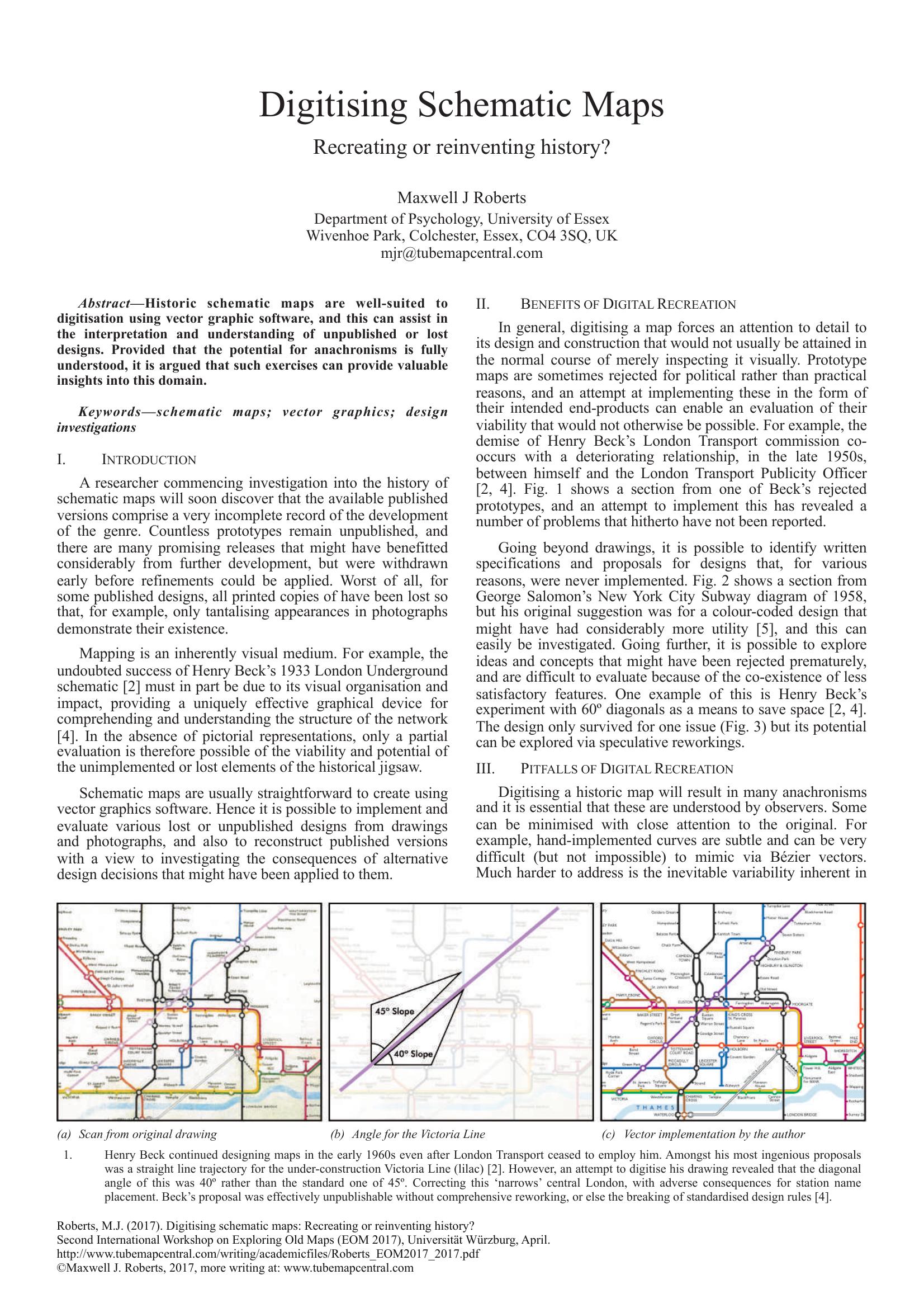
Maxwell J. Roberts argues that historic schematic maps are well suited to digitisation with vector graphics, enabling researchers to reconstruct, evaluate, and reinterpret unpublished, lost, or prototype designs. Digitisation enforces close attention to design details, exposing practical issues and allowing exploration of alternative decisions—examples include Henry Beck’s rejected London Underground prototypes and George Salomon’s unimplemented colour-coded New York design. Digital recreation can reveal problems not evident from photographs or notes and permit speculative reworkings of short-lived experiments. However, Roberts cautions that digital reconstructions inevitably introduce anachronisms: perfectly regular vector lines, smoother curves, and uniform stroke widths contrast with historic variability from hand-drawing and older print processes. Lettering is particularly problematic, since hand-drawn characters and inconsistent typesetting resist faithful digital substitution without laborious tracing. Consequently, digital maps are representative rather than authentic, but—if compromises are acknowledged—such recreations provide valuable insight and allow historic designs to be fairly compared with modern equivalents.
Additional information
| Pages | 2 |
|---|---|
| Filesize | 1Mb |
Related products
-
Association of Transport Co-ordinating Officers – PRINTED PUBLIC TRANSPORT INFORMATION 2003
£0.00 Add to basket -
Attoma – MAPPING MOBILITY 2024
£0.00 Add to basket -

Association of Train Operating Companies Passenger Information Strategy Group – GOOD PRACTICE GUIDES FOR PROVIDING INFORMATION TO PASSENGERS 2008
£0.00 Add to basket -
Allsop – DETERMINING WHICH REQUIREMENTS OF PUBLIC TRANSPORT USERS IN LARGE CITIES COULD BE MET BY MODERN INFORMATION TECHNOLOGY 1987
£0.00 Add to basket