Booth – TRANSIT MAPS 2011 2011
£0.00
A downloadable PDF file for your personal use.
Description
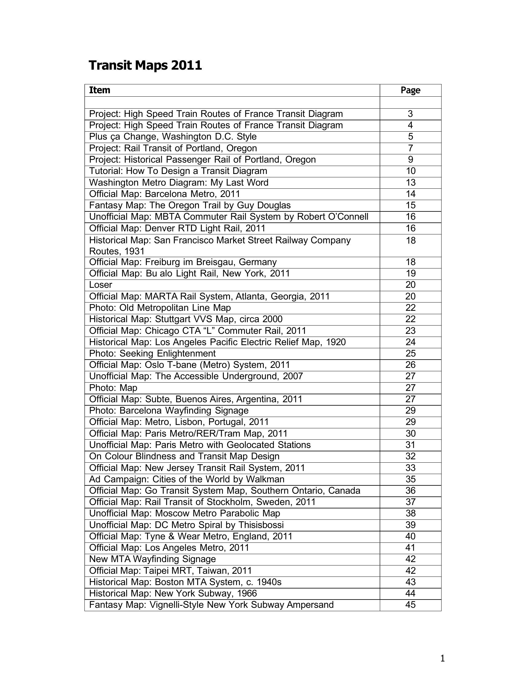
Transit Maps 2011 is a yearlong collection of transit-map projects, critiques and design guidance emphasizing clarity and diagrammatic thinking. Major works include a High Speed Train Routes of France diagram, an Eisenhower interstates-as-subway rework, multiple Washington, D.C. Metro redesigns, and unified contemporary/historical rail maps for Portland. A detailed “How To Design a Transit Diagram” outlines planning, vector software use, defined grids, manual curve-building, consistent typography, layers and global colours. The book surveys dozens of official, historical, unofficial and fantasy maps—praising Barcelona, Stuttgart, San Francisco, Paris, Lisbon, Toronto’s Go Transit, Kiev and Wikipedia-quality MBTA work, while criticizing Buffalo, NJ Transit and SEPTA for clutter or poor colour use. Recurring themes are the trade-off between geographic accuracy and legibility, the effectiveness of restrained visual rules, resistance to innovation, and accessibility concerns: London’s 2007 “Accessible Underground” map and advice on colour-blind-friendly contrast and labelling are highlighted. Creative and historical treatments (Moscow parabolic, DC spiral, Vignelli) show mapping’s artistic and cultural evolution.
Additional information
| Pages | 59 |
|---|---|
| Filesize | 4.3Mb |