Booth – TRANSIT MAPS 2012 2012
£0.00
A downloadable PDF file for your personal use.
Description
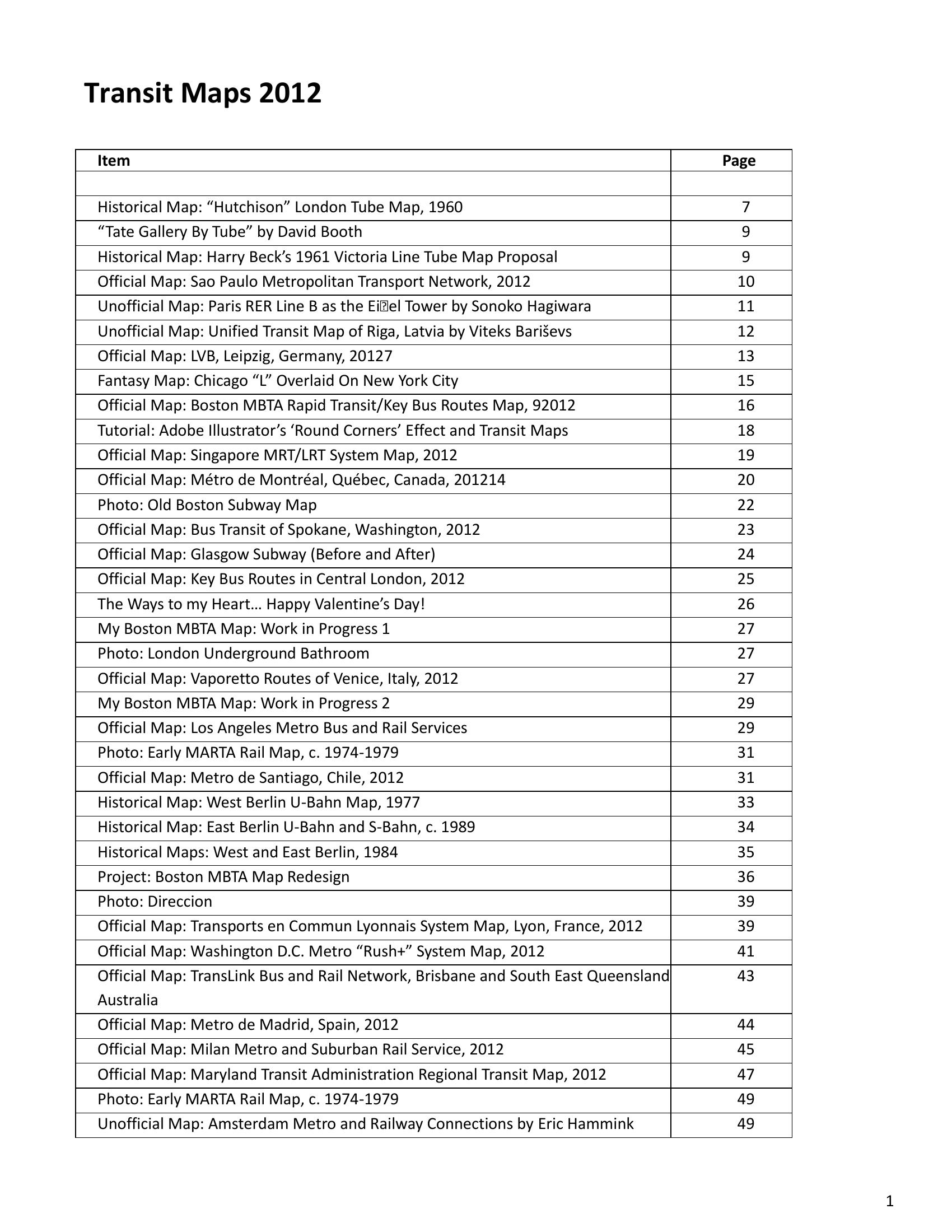
Transit Maps 2012 is a global catalogue and critique of official, unofficial, historical and fantasy transit maps that evaluates clarity, legibility, information hierarchy, typography, colour, geographic abstraction and technical craft. The posts review city maps, creative reinterpretations and historical snapshots, highlighting multimodal integration, visual hierarchy (e.g., line thickness for frequency), and the need for considered redesigns such as a multi-part Boston MBTA project. Praise is given to elegant, user-focused designs (examples include Singapore, Montreal, Lyon, Hong Kong, Amsterdam, Zurich night services and standout individual works), while cluttered, poorly integrated or typo-ridden maps (Boston, Sao Paulo, LA, Rio, Salt Lake City, Washington DC and others) are criticized. Historical and speculative maps are valued for context and storytelling, and creative/fantasy maps show cultural and pedagogic uses. Practical material includes photo documentation and an Adobe Illustrator tutorial. Overall the collection stresses balancing visual boldness with usability—clear colour coding, consistent craft, legible type and meaningful legends are essential.
Additional information
| Pages | 207 |
|---|---|
| Filesize | 27.6Mb |
Related products
-
Association of Train Operating Companies – PRESENTATION OF TIMETABLE INFORMATION 1997
£0.00 Add to basket -

Anon – ONLY CONNECT 1987
£0.00 Add to basket -
American Public Transit Association – TRANSIT MAPS 1984
£0.00 Add to basket -

Association of Train Operating Companies Information Development Group – GOOD PRACTICE GUIDES FOR CUSTOMER INFORMATION 2013
£0.00 Add to basket