
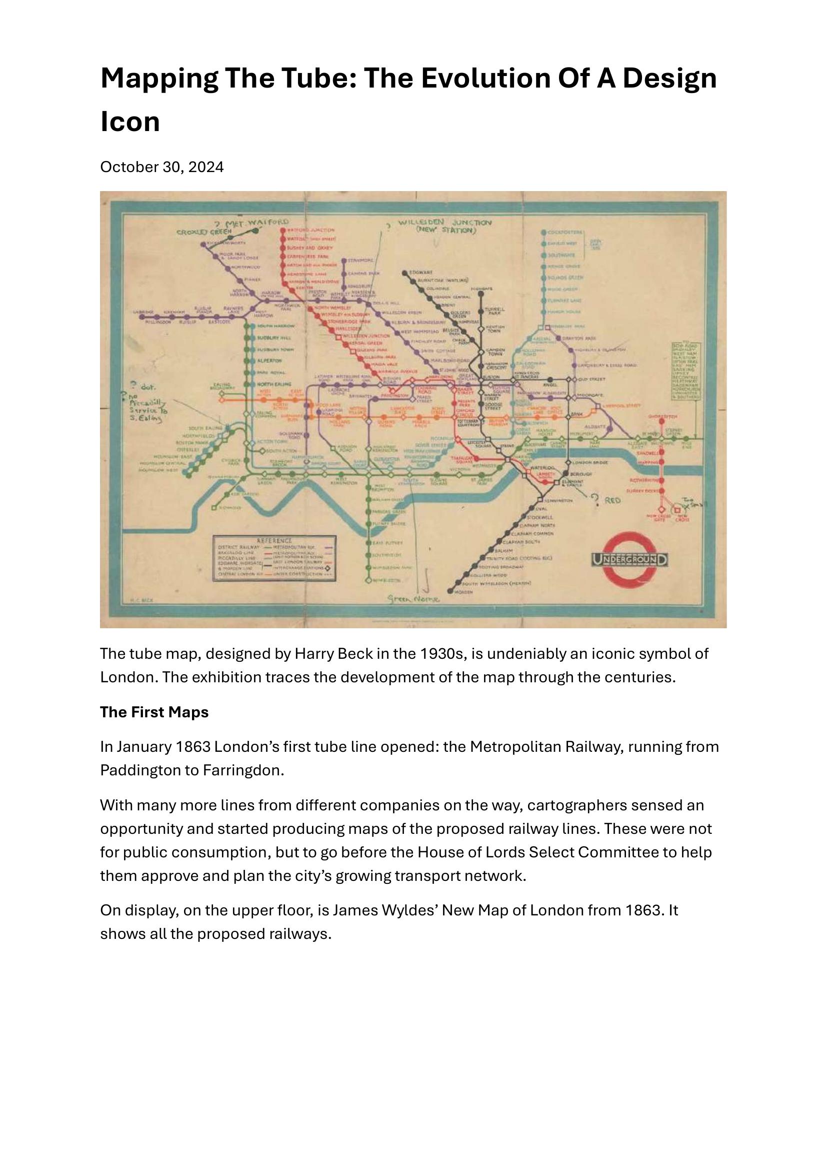
Chesher – MAPPING THE TUBE 2024
£0.00
A downloadable PDF file for your personal use.
Description
The exhibition traces the evolution of London’s tube map from 1863 to the present, highlighting how design met the city’s transport needs. Early maps, like James Wylde’s 1863 plan and the 1880 Improved District Railway Map, responded to the first Metropolitan Railway and a legal boundary that forced underground links. By the early 20th century the network, consolidated under the UERL, produced geographically faithful but cluttered “spaghetti” maps; Fred Stingemore’s 1920s smoothing still left inefficiencies. Publicity efforts by Frank Pick used artists (e.g., Macdonald Gill’s 1914 Wonderground) to encourage ridership. Harry Beck, an engineering draughtsman, revolutionized the map in the 1930s with a circuit-diagram approach—straightened lines, diagonals and even station spacing—produced affordably and widely influential. The show includes Beck’s annotated proofs and sketches, rare 1933 posters, global echoes such as a 1939 Sydney map, a timeline of customer maps (including WWII limitations), and modern reinterpretations like Maxwell Roberts’ concentric-circle design.
Additional information
| Pages | 13 |
|---|---|
| Filesize | 2.2Mb |
Related products
-
Association of Transport Co-ordinating Officers – PRINTED INFORMATION AT BUS STOPS 2004
£0.00 Add to basket -
Association of Train Operating Companies – PASSENGER INFORMATION DURING DISRUPTION 2014
£0.00 Add to basket -
Annear – A TWIST ON THE MBTAS MAP DESIGN 2014
£0.00 Add to basket -
Association of Train Operating Companies – HOW TO PRESENT TIMETABLE INFORMATION 2005
£0.00 Add to basket