
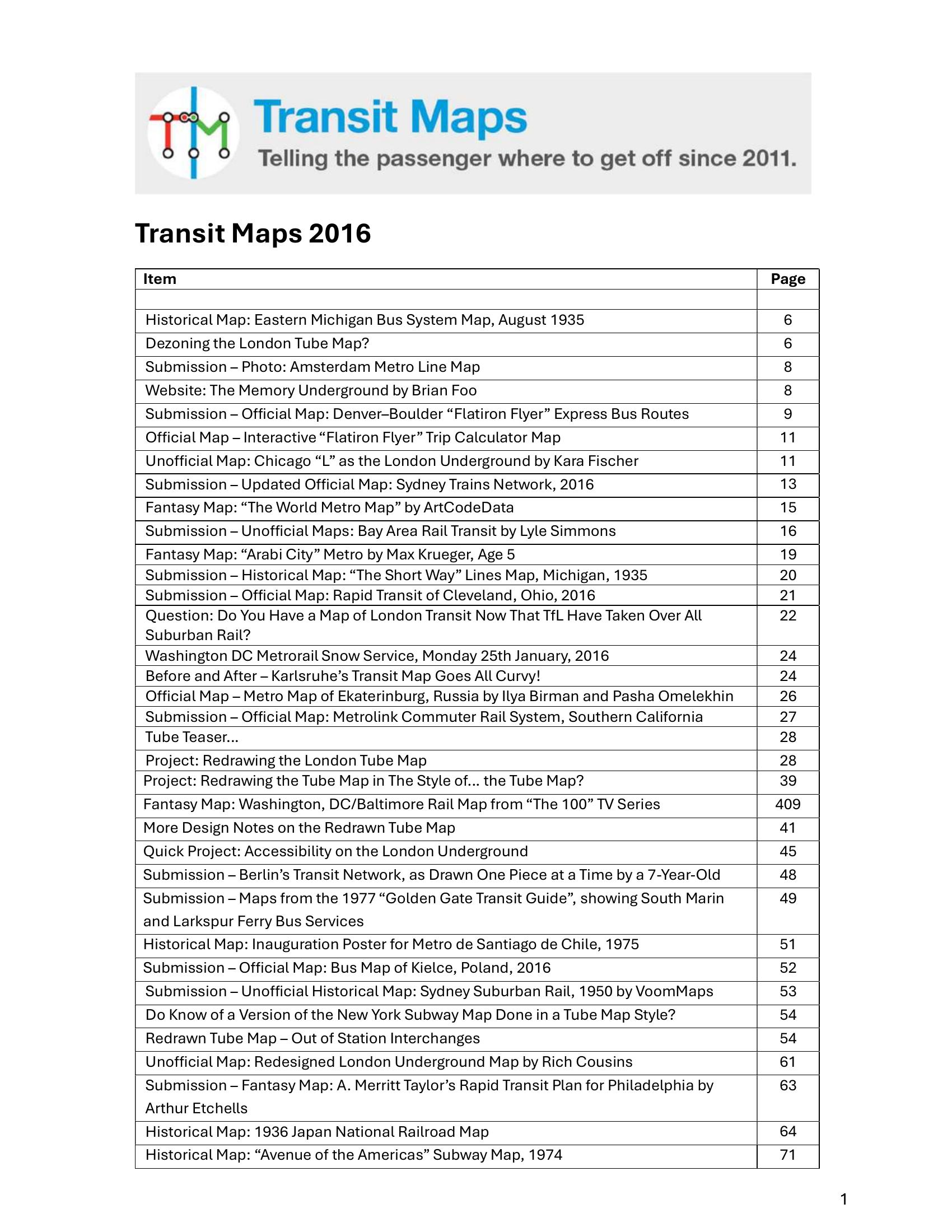
Booth – TRANSIT MAPS 2016 2016
£0.00
A downloadable PDF file for your personal use.
Description
The Transit Maps 2016 digest compiles global news, reviews and projects in transit cartography, ranging from historical discoveries and playful submissions to practical redesigns and experimental schematics. Key updates include new official maps for Sydney, Denver–Boulder’s Flatiron Flyer, Cleveland, Southern California Metrolink and Ekaterinburg, plus many unofficial and fantasy proposals. A centerpiece is a detailed London Tube redesign proposing removal of fare-zone shading, grid-based alignments, streamlined accessibility icons, Crossrail integration and clearer interchange treatment; responses were largely positive, though commenters pressed for consistent accessibility symbols, better out-of-station interchange handling, clearer branch colouring and inclusion of Tramlink. Recurring critiques across posts stress legibility, accurate station placement, uncluttered hierarchy and honest marketing (e.g., Flatiron Flyer BRT claims). Other highlights include a reconstructed 1920 Portland streetcar project, tactile MBTA work, data visualisations, print-prep guidance and numerous rated reviews of regional and historical maps. Overall the collection champions clarity, iterative refinement and thoughtful information design in transit mapping.
Additional information
| Pages | 240 |
|---|---|
| Filesize | 17.9Mb |
Related products
-

Association of Train Operating Companies – PRESENTATION OF TIMETABLE INFORMATION 1997
£0.00 Add to basket -
Association of Transport Co-ordinating Officers – PRINTED INFORMATION AT BUS STOPS 2004
£0.00 Add to basket -

Association of Train Operating Companies – HOW TO PRESENT TIMETABLE INFORMATION 2005
£0.00 Add to basket -
Anon – PICTURE THE TRANSIT SYSTEM EFFECTIVELY WITH A ROUTE MAP 1970
£0.00 Add to basket