
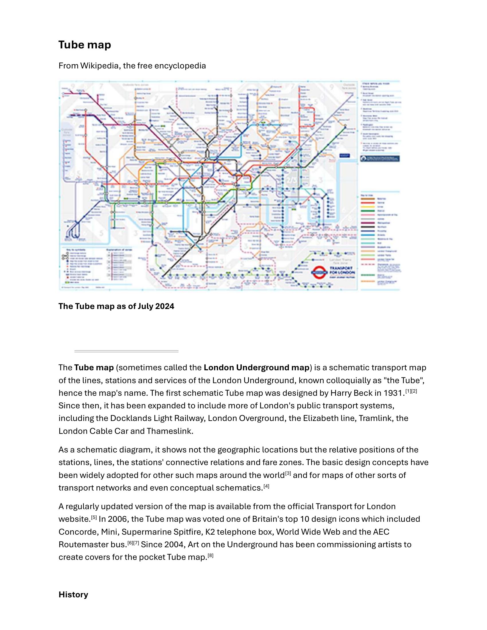
Wikipedia – TUBE MAP 2025
£0.00
A downloadable PDF file for your personal use.
Description
The Tube map is a schematic diagram of London’s rapid transit network, created to show lines, stations and connections rather than precise geography. Harry Beck’s 1931 topological design—using straight segments, 45° angles and simplified station symbols—revolutionised transit mapping and remains the basis for the modern map. Over time the map expanded to include Docklands Light Railway, London Overground, the Elizabeth line, Tramlink, Thameslink and other TfL services, while retaining features such as Johnston typeface, standardised line colours and interchange markers. Variants (large-print, Night Tube, step-free guide, walking-distance and London Connections) and special pocket-map covers by Art on the Underground address different user needs. Notable changes include periodic inclusion of the River Thames and fare zones, and additions of non‑Underground lines as services moved under TfL. The map’s clarity inspired global imitations, spin‑offs (bus “spider maps,” isochrones) and alternate proposals seeking greater geographic accuracy. Its iconic design is widely celebrated and frequently referenced in culture and design discourse.
Additional information
| Pages | 16 |
|---|---|
| Filesize | 0.4Mb |
Related products
-
Association of Train Operating Companies – PASSENGER INFORMATION DURING DISRUPTION 2014
£0.00 Add to basket -
Attoma, Dubuc and Boyer-Moraes – MAPS BY ATTOMA 2014
£0.00 Add to basket -

American Public Transit Association – TIMETABLES 1982
£0.00 Add to basket -
Attoma – MAPPING MOBILITY 2024
£0.00 Add to basket