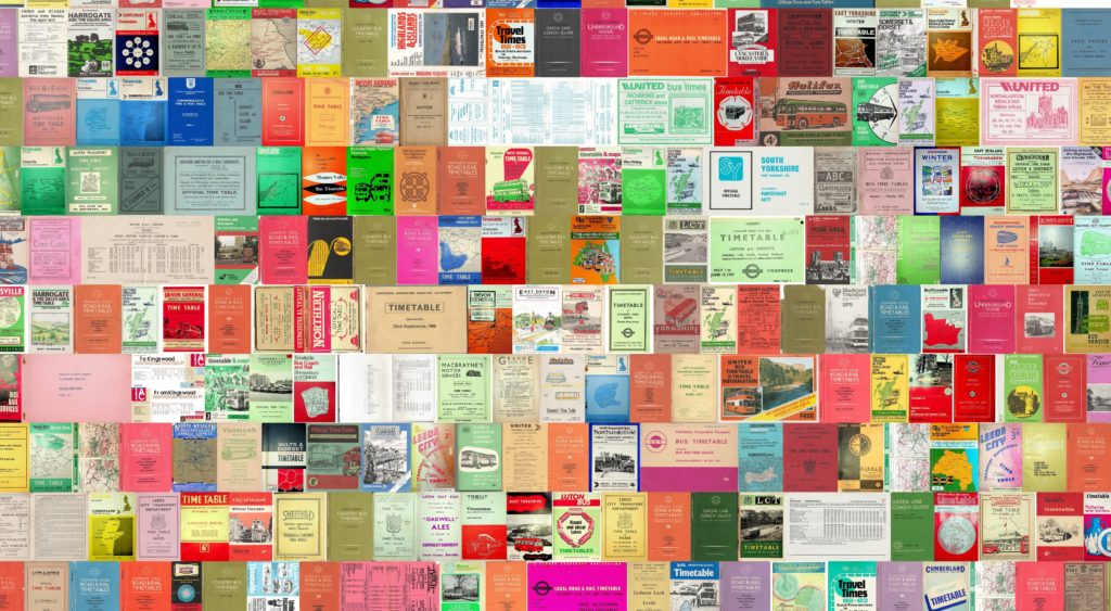
Timetable World is the online collection of historical transport timetables and maps from around the World

A free-to-use digital archive for those interested in transport, social history, local studies and the like
Scroll down to discover more ...
April 2024
Around 150 more timetables have been added, including:
- Five more LNER timetables in the Great Britain "Big Four" (1923-47) series
- Four Thomas Cook guides
- Various items for Germany, France
- Many new airline guides
- About 100 new GB Bus timetables, focussed on Yorkshire and North East England.
Many more PDF editions of previously-published timetables are now available to download. Free access to online editions is unchanged.
The menus have been restructured. There are more country-specific and subject-specific pages available, which provide an alternative way to navigate the collection.
February 2024
A growing proportion of the collection is available to download as PDF files as well as to view online free-of-charge. A new feature in Timetable Search is a direct link to the PDF.
New material: The focus for this release is timetables and maps for India. There are now over 200 examples, some having national coverage, such Newman' Indian Bradshaw, and All India, and others for the regions (now called "Zones"). We have also extended the coverage of Romania, which is now comprehensive for the post-War years 1945-2013.
A great collection of pre-War bus timetables for Yorkshire (Great Britain) has also been added.
December 2023
500+ bus timetables as PDF downloads
Timetable World is now offering its UK bus timetable collection as downloadable PDF files. The collection has grown over the last three years to exceed 500 representative items from all regions and most eras. Each PDF has been OCR'd to make the text searchable.
A small charge is made for most of the PDFs (£2 - £8) but some are available for free download. The proceeds help to pay for the servers and electricity bills, with some left over (we hope) to buy more timetables.
We started offering railway timetables on this basis a year ago, and it has proved to be successful. So we have high hopes that bus timetables will also be popular.
UK bus timetables page,
September 2023 · Latest additions
109 free timetables added
Highlights include:
- A 1946 timetable for the American sector of Germany, showing a network at its lowest ebb
- An almost-complete set of CFR (Romania) timetables. A page to showcase these is being prepared
- Many more books covering bus services in northern England.
Visit Timetable Search, and select 2023-08 as the release date.
More indexing jobs
Timetable World relies on volunteers to help bookmark the timetables. Most of the 109 new timetables are now available to work on. Post-Covid, people have less free time at home and the backlog of work has built up. Visit the Volunteer page.
1948-73 bundles added to GB Railway Series
It is now possible to purchase bundles of five or six PDFs covering the whole of Great Britain at each period. Individual regions are still available but bundles offer a saving of 50-58%. Visit GB Railway Series.
1923-47 "Big Four" timetables
In this centenary year of the creation of the Big Four railway companies in Great Britain, Timetable World is pleased to launch a representative 85 timetables for most years. Timetables of this age are rare and expensive to buy, but they are offered here as searchable PDF downloads at just £6 each. Visit The "Big Four" 1923-1947.
New rotation tool added
The orientation of timetables can vary even with a single page. We have added a new Rotation tool into the online timetable viewer so that you can make your own choices how best to view a page.


Welcome to Timetable World
Timetable World is a fully-digital historical archive. The online archive covers transport modes with regular schedules, meaning railways, urban transit, bus services, and airlines. It is not a journey planner.
The aim is to have representative examples at different times, not comprehensive coverage of every time period. The focus is on timetable books that cover transport networks rather than separate leaflets.
The archive has over 1,000 timetables and maps from 80 countries available to view, and is growing rapidly.
The viewer
Timetables are scanned at high resolution. Complete books are presented as a grid, rather like microfiche, which is best for general browsing. The same viewer is also used for displaying large maps.
The viewer supports up/down and left/right movements (panning) and in/out movements (zooming). There are additional tools, as follows:
- Bookmarks are available on most timetables to help users jump to specific locations
- Your place can be saved for later, and shared with others via social media
- Camera snapshots can be taken. A free Timetable World account is required to use this feature.
Look for the User Guide tab on the Timetables and Maps pages.
Volunteering
Timetable World is run entirely by volunteers. The archive is non-commercial, free to use, and privately funded by the administrator. If you find it useful, please consider what you can give back.
Timetable donations or loans and additional willing helpers are always welcome. Indexing of timetables can be carried out online after signing up via the Volunteer page. The small team of people with scanning equipment make the archive possible, and we could deliver more with extra people.

Using Timetable World
We are delighted that a video content creator - CityNerd - has used Timetable World as the primary source for this review of passenger rail in the US in 1925, and of what has been lost.
The video lasts 17:11, and Timetable World gets a big plug at 2:43.
The main timetable used is The Official Guide of the Railways 1925-12:
- View online [free-of-charge]
- Download searchable PDF [GBP £10]
- Other Official Guides
Articles
The following articles provide background to help you navigate the content in Timetable World and give you a head-start in making your own discoveries.
Great Western Railway - 1931 Service Timetables
User guide to the timetable viewer
1872 railway map of England & Wales
Navigating the Official Guide (North America)
Newsletters
Steam in Poland

In the late 1980s, Poland was the last country of Europe which still had widespread use of main line steam locomotives. It also had a very dense network of branch lines, as many people relied upon public transport for their daily commute, with car ownership being relatively uncommon. Modernisation of the railway was taking place – principally in the form of electrification.
We pull together a collection of public and employee timetables and maps for Poland after 1945. They include a 1987 timetable with detailed annotations identifying steam operation.
Great Western Railway - 1931 Service Timetables

Timetable World is delighted to be able to bring you a full set of Great Western Railway service timetables (facsimiles), commencing September 1931, as issued to GWR employees.
In 15 sections, they list every scheduled train of all classes – passenger, mail, milk and other perishable goods, general goods, minerals, coal, and the like, for every main and branch line and mineral railway. Additionally, the September 1931 timetable recorded the paths reserved for summer-only services, which were marked as “suspended”.
2,488 pages.
In addition to train timings, there are invaluable reference pages:
- Lists of signal boxes, with operating hours
- Lighting up times
- Lists of crossovers
- Speed limits
- Refuge sidings and loops
- Shunting engine duties, locations and days of operation
- Wagon classifications
- Line loadings
Service timetables are published in two forms:
- A digital download. The ZIP file contains a PDF for each of the 15 sections and an index file. Purchase from the Timetable World shop.
- A two-volume set of printed books. The books are supplied by Amazon and can be purchased separately. Search Amazon with "Timetable World"
The original timetables were printed on cheap paper over 90 years ago and are yellowed and brittle. The scans have been whitened but any imperfections in the originals will remain. The scan quality can be assessed by looking at the image samples provided in the shop and using "Look Inside" on Amazon.
The printed books are presented as two original pages per facsimile page. The scans are 80% the size of the originals, and still easily legible.
The digital download is 749Mb. We suggest downloading to a desktop computer - and, if you have a slower connection, being patient.
User guide to the timetable viewer
The timetable viewer has been adapted from an off-the-shelf tool for viewing online maps, known as Leaflet. The tool is well suited for displaying timetables as a grid.
Some additional tools have been added by Timetable World to aid navigation, save your place, and take snapshots, and it will help your enjoyment of the archive if you familiarise yourself with the available features.


GB bus operations
Bus services in Great Britain have gone through several cycles of private ownership, central government and municipal ownership, and varying levels of regulation.
This article provides an introductory overview of how the industry developed. Timetable World aims to publish representative timetables from each era.
1872 railway map
The Richard Price-Williams map of England & Wales provides an interesting - and detailed - snapshot of railways built and railways authorised at the time.
In this article, you can read a biography of Price-Williams.
There is also focus on two regions where railway development subsequently went in different directions. In Shropshire, the county's early promise as the cradle of the Industrial Revolution was already fading and most of the authorised lines were abandoned before construction. In largely-rural Norfolk, Price-Williams was too early to witness the subsequent burst of railway construction as the Great Eastern Railway lost its hegemony.


Thomas Cook's timetables
1973 was a time for optimism at Thomas Cook. The international timetable reached its Centenary and an era of increased rail travel via the Channel Tunnel beckoned. A special edition of the timetable was published, and Timetable World reproduces the special section here.
Thomas Cook went on to launch its Overseas Edition in 1981 by separating out the non-European timetables. But ... the 1970s Tunnel, then in the early stages of construction, was abandoned.
Thomas Cook Group is no more. The timetable survives under new management but the overall travel group fell into receivership in 2019.
Navigating “The Guide”
Unfamiliar with North America’s Official Guide of the Railways?
Read this introduction to “The Guide” to welcome you to an excellent – and complex – resource


Leeds City Tramways, Great Britain
The city of Leeds in Northern England had an extensive tramway system until 1959, and was connected to the networks of several separate operators. It is an urban myth that you could reach Liverpool (75 miles, 120km) by tram - but there was only a small gap.

Cross Gates
After removal of the tram tracks, Leeds was left with several roads with wide medians, such as this example at Cross Gates. Some sections have in recent years been converted into guided bus-ways.
A booklet covering the history 1871 - 1959 was published by the West Yorkshire Passenger Transport Executive in 1981 and written by P.R. Garside. It is available to download as a PDF file here.
Timetable World also has a 1944 Map which shows the network being pruned during the War.
Also available: Map: Trams - Various areas 1940s-50s [Great Britain]
The Berlin Corridor
Timetable World is grateful to Robert W. Rynerson for permission to reproduce his article about military trains serving the corridor to West Berlin. He was stationed there with the U.S. Army Berlin Brigade 1969-71, and made several journeys utilising the dedicated services for American, British, and French military personnel.
